Know About How GPS Works: Everything You Need

The GPS system consists of three main components working together. Satellites broadcast signals containing precise timing and location data. Ground stations monitor these satellites, while receivers process the signals to determine their position.

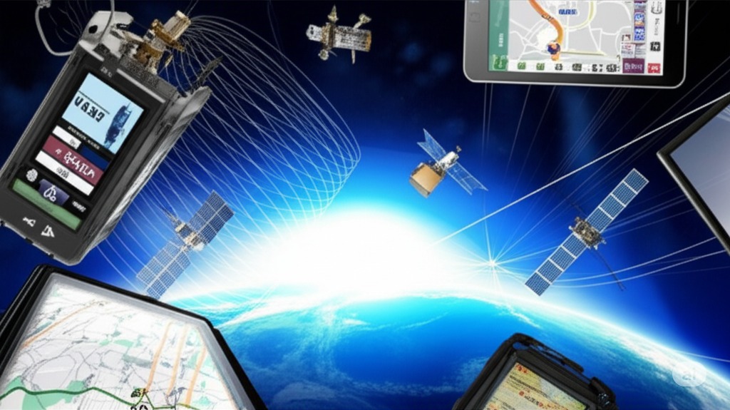
GPS System Components

  • GPS stands for Global Positioning System, a network that supports fleet safety and asset tracking through precise location services
  • The system was originally developed for military use but has since become an essential part of civilian infrastructure
  • Powers everything from smartphone navigation to precision agriculture and fleet management applications

This technology forms the foundation for modern tracking and navigation applications across all industries.

GPS system architecture and satellite positioning diagram
Know About How GPS Works: Everything You Need - Professional GPS tracking and fleet management solution

GPS Device Tracking System Overview: How Accurate is GPS

Segments of Operation: GPS Signals, GPS Receivers, Global Positioning Satellites. The space segment includes multiple GPS satellite blocks broadcasting signals. The control segment monitors and maintains the system, while the user...

Global Positioning Satellite System: How the Segments Work Together

  • Space Segment: Constellation of satellites orbiting Earth
  • Control Segment: Ground stations monitoring satellite health and accuracy
  • User Segment: GPS receivers in vehicles, phones, and other devices

This three-part system provides reliable positioning data for fleet management and asset tracking applications worldwide.

GPS location tracking on mobile device with map interface
GPS Device Tracking System Overview: How Accurate is GPS - Professional GPS tracking and fleet management solution

GPS Tracking System Does Its Job

Position calculation requires signals from multiple GPS satellites. Through trilateration, receivers determine their exact location by measuring distances to several satellites simultaneously.

Trilateration Process

  • Measure time signals take to travel from satellites
  • Calculate distance to each satellite
  • Determine position where all distances intersect
  • Apply correction factors for atmospheric effects

GPS receivers calculate position using these mathematical steps to provide accurate location data.

GPS trilateration process showing satellite positioning calculations
GPS Tracking System Does Its Job - Professional GPS tracking and fleet management solution

Used Today: GPS Applications

Modern GPS applications span various industries. From fleet management to asset tracking, organizations rely on GPS system solutions for daily operations. Digital events tracking and smart city applications demonstrate the technology's versatility.

Industry Applications

  • Fleet maintenance scheduling through GPS tracking
  • Asset tracking for equipment management
  • Cable assembly installation monitoring
  • Online support for system users
  • Partner platform integration

These applications help businesses improve operations, reduce costs, and improve customer service through real-time location tracking and data analysis.

GPS tracking applications in electrical and utility industries
Used Today: GPS Applications - Professional GPS tracking and fleet management solution

Know About GPS Implementation

The system satellite system requires proper implementation for effective performance. For fleet management applications, this includes selecting appropriate hardware and maintaining fleet safety standards through regular system checks.

Support Update for Implementation

  • Install magnetic mount GPS receivers according to specifications
  • Configure online support documents for system access
  • Set up fleet maintenance schedules
  • Establish cable assembly connections
  • Monitor digital events through the platform

Following these implementation steps ensures best performance and reliability of your GPS tracking system.

Professional GPS tracking hardware device for fleet implementation
Know About GPS Implementation - Professional GPS tracking and fleet management solution

GPS Tracking System Solutions

US Fleet Tracking provides comprehensive tracking solutions. Their systems support end-user requirements across various industries, from construction to delivery services.

Solution Features

  • Real-time fleet management solution
  • Video-based safety monitoring
  • Asset tracking features
  • Smart city applications
  • Educational webinars for users

These comprehensive solutions help businesses of all sizes improve their operations and enhance efficiency through advanced GPS tracking technology.

GPS tracking solutions for construction and heavy equipment industries
GPS Tracking System Solutions - Professional GPS tracking and fleet management solution

Frequently Asked Questions

Use Enter or Space to expand FAQ answers. Use Tab to navigate between questions.

GPS works by using a network of satellites orbiting Earth that transmit precise timing signals to GPS receivers. The receiver calculates its position by measuring the time it takes for signals to travel from multiple satellites, using triangulation to determine exact location coordinates with remarkable accuracy.

GPS works accurately through atomic clocks on satellites that provide precise timing, multiple satellite signals for triangulation, and sophisticated algorithms that account for atmospheric interference. The system requires signals from at least four satellites to calculate three-dimensional position and time with meter-level accuracy.

GPS satellites work by orbiting Earth at approximately 12,550 miles altitude, continuously broadcasting timing signals and orbital information. Each satellite contains atomic clocks and transmits data about its position and time, enabling GPS receivers to calculate distances and determine precise locations through mathematical triangulation.

GPS signal transmission involves satellites broadcasting radio waves on specific frequencies that carry timing codes and navigation data. These signals travel at the speed of light from satellites to GPS receivers, which measure signal travel time to calculate distances and determine precise positioning coordinates.

GPS calculates position by measuring the time it takes for signals to travel from multiple satellites to the receiver. Using the known speed of light and signal travel times, the system determines distances to each satellite and uses triangulation mathematics to pinpoint the exact three-dimensional location.

GPS components include space satellites, ground control stations, and user receivers that work together to provide positioning services. The space segment consists of orbiting satellites, the control segment manages satellite operations, and the user segment includes GPS receivers that calculate positions from satellite signals.

GPS positioning accuracy typically achieves 3-5 meters for civilian users under optimal conditions, with professional systems reaching sub-meter precision. Accuracy depends on satellite geometry, atmospheric conditions, signal quality, and receiver technology, with modern systems providing reliable positioning for most applications.

GPS signal quality is affected by atmospheric interference, physical obstructions like buildings or trees, satellite geometry, and receiver quality. Weather conditions, ionospheric disturbances, and multipath signals can impact accuracy, while clear sky views and quality receivers optimize GPS performance.

GPS receivers work by detecting satellite signals, measuring signal travel times, and calculating positions through mathematical algorithms. These devices process timing data from multiple satellites simultaneously, account for various error sources, and provide location coordinates through integrated processing systems.

GPS triangulation is the mathematical process of determining position by measuring distances to multiple known satellite locations. By calculating ranges to at least three satellites, GPS receivers can determine two-dimensional position, while a fourth satellite enables three-dimensional positioning and time calculation.

GPS maintains accuracy through continuous satellite monitoring, ground control station corrections, and advanced error compensation algorithms. The system accounts for atmospheric delays, satellite clock errors, and orbital variations while providing regular updates to ensure consistent positioning performance worldwide.

GPS time synchronization uses atomic clocks on satellites to provide extremely precise timing references for position calculations. This synchronized time system enables accurate distance measurements between satellites and receivers, forming the foundation for precise GPS positioning and navigation capabilities.

GPS ground stations work by monitoring satellite health, updating navigation data, and maintaining system accuracy through continuous oversight. These control facilities track satellite orbits, upload corrections, and ensure optimal system performance while coordinating global GPS operations and maintenance activities.

GPS signal structure consists of carrier frequencies, navigation messages, and timing codes that enable position calculation. Satellites transmit on multiple frequencies carrying orbital data, timing information, and system status, allowing receivers to process signals and determine accurate positioning coordinates.

GPS handles interference through signal processing techniques, error correction algorithms, and multiple satellite redundancy. The system can filter noise, compensate for atmospheric effects, and maintain positioning accuracy even when some signals are degraded or temporarily unavailable.

GPS constellation design involves strategically positioning satellites in specific orbits to ensure global coverage and optimal geometry for accurate positioning. The constellation includes multiple orbital planes with satellites distributed to provide continuous visibility and reliable signal availability worldwide.

GPS provides continuous coverage through a constellation of satellites in medium Earth orbit that ensures multiple satellites are always visible from any location. The orbital design guarantees that GPS receivers can access sufficient satellite signals for positioning calculations at any time and place.

GPS error correction involves various techniques to improve positioning accuracy by compensating for atmospheric delays, satellite clock errors, and signal distortions. Advanced systems use differential corrections, carrier-phase measurements, and sophisticated algorithms to achieve enhanced precision for demanding applications.

GPS works in different environments with varying performance levels depending on signal obstruction and interference factors. Open areas provide optimal accuracy, while urban canyons, forests, and indoor locations may experience reduced performance, requiring assisted GPS or alternative positioning technologies.

GPS technology reliability stems from redundant satellite systems, continuous monitoring, robust signal processing, and decades of operational refinement. The system's global infrastructure, error correction capabilities, and multiple backup systems ensure consistent performance for critical navigation and positioning applications worldwide.